
Twentynine Palms ZIP Code Directory
ZIP 92277 is the principal community street and mail ZIP associated with Twentynine Palms. The USPS facility listed for the area is at 73839 Gorgonio Drive, with the phone number published by USPS. A postal label helps locate an address in a mail system. It is not proof that every address carrying the label falls inside the incorporated city boundary.
| ZIP | Areas covered | Post office | Notes |
|---|---|---|---|
| 92277 | Principal Twentynine Palms community street and mail area | 73839 Gorgonio Drive; 760-367-1161 | Postal name is not city-limit proof |
| 92278 | Marine Corps Air Ground Combat Center | 1435 Sturgis Road, Building 1435 | Installation ZIP, not an ordinary neighborhood slice |
A ZIP search should keep the postal role beside the parcel and city layers. If the goal is a person, the ZIP is only a filter. The record that follows must identify the fact being sought, such as a parcel, a filed instrument, an event, or a historical listing.
The USPS Twentynine Palms facility listing is the source for the 92277 post-office detail.
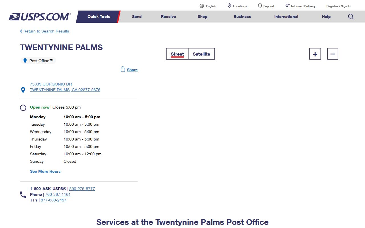
The facility confirms a postal service point. It does not turn the ZIP into a resident roll.
Twentynine Palms ZIP Code 92278
ZIP 92278 is identified in the research as the Marine Corps Air Ground Combat Center installation ZIP. It should not be treated as a normal neighborhood band around Twentynine Palms. A name or address associated with 92278 may reflect the installation's service geography, a mailing convention, or a record held by a federal or military custodian.
When a ZIP search returns an installation address, confirm the record's jurisdiction before moving to a city or county office. The city GIS and County Parcel Access layers can help with a parcel when one exists, but the ZIP alone cannot say whether an address is inside the city, the Sphere of Influence, the installation, or another county layer.
This distinction is the key geography fact in a Twentynine Palms postal search. The two ZIPs do not represent two equal residential slices.
Twentynine Palms ZIP Code Search
Use the ZIP as a narrowing key, then move to a named record source. A county property search can filter an address by city, state, and ZIP. The result should be checked against the parcel map, APN, situs address, mailing distinction, and any legal description. For historical people, use the ZIP only as a clue because older directories may print a road or locality without a modern ZIP.
- Enter the ZIP and city or state in the property search. Treat the return as a candidate address, not a confirmed city parcel.
- Check the address or APN in County Parcel Access and the Twentynine Palms GeoViewer. Save the boundary or Sphere of Influence layer that applies.
- Use the APN or owner lead for a Recorder search if a deed or other instrument is relevant. The Recorder cannot begin with a street address.
- For one person, choose the matching court, vital, business, license, cemetery, or historical source and compare a second dated record.
- Write down what the ZIP establishes, what the parcel establishes, and what the person record establishes. Keep those claims separate.
Street-level work belongs in the Twentynine Palms street directory workflow once the ZIP has narrowed the search.
Twentynine Palms Property Search by ZIP
County Citizen Access is the verified local property tool with ZIP fields. Its Address mode accepts a street-number range, street name, city, state, ZIP, and a choice about whether the mailing address is the same as the physical address. Parcel Information and Record Information modes provide other entry points. The search is a property lookup, not a people directory.
| Citizen Access field | Type | Use in a ZIP search | Caution |
|---|---|---|---|
| Street Number | Range | Narrow the physical address | Do not omit unit or range context when shown |
| Street Name | Text | Use a road such as Main | Test old road wording where needed |
| City / State | Selectors or text | Pair the postal label with jurisdiction fields | Postal city is not city-limit proof |
| Zip | Text | Filter 92277 or 92278 | ZIP role differs between the two codes |
| Mailing same as physical | Yes / No | Compare correspondence and situs | Does not establish current presence |
The San Bernardino County Citizen Access property lookup is the source for these fields.
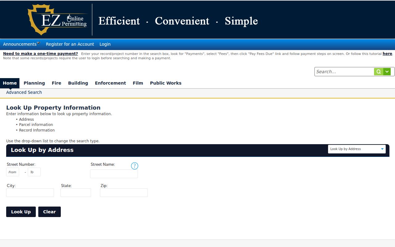
The address form shows how a ZIP can narrow a parcel search while still requiring city, state, street, and mailing comparisons.
Note: A ZIP field is a search filter; an APN and legal description are the stronger bridge to a county parcel record.
Twentynine Palms ZIP Codes and Limits
Postal city, incorporated boundary, Sphere of Influence, military installation, and assessor jurisdiction can differ. Use the city GeoViewer's city and Sphere of Influence layers to test the civil geography. County Parcel Access supplies the county parcel view. If a result falls near a boundary, save a screenshot or note the layer and access date rather than relying on the postal label alone.
A postal filter also has no power to show a complete household. It can organize address candidates. It cannot disclose protected voter data, DMV information, utility customer information, or every person connected with a parcel. The next source must be selected by the record question and its lawful access path.
Boundary check. Use the ZIP to narrow the search, the map to test jurisdiction, and the custodian's record to support the final fact.
Twentynine Palms Address Field Definitions
Four address terms recur in a ZIP search. Situs is the physical parcel location. Mailing address is where correspondence goes. Legal description is the deed language that identifies land through a tract, subdivision and lot or a section, township and range description. APN is the county tax-parcel number. A ZIP code is a postal routing label. Each term belongs in a separate field.
- ZIP code
- A postal routing code that can cover an area or special installation role.
- ZIP+4
- An extended postal code that narrows delivery routing beyond the five-digit ZIP.
- PO-box or installation ZIP
- A code serving a special delivery setting, which may not map to an ordinary neighborhood.
- Carrier route
- A delivery route within postal operations, not a parcel or resident identifier.
When the fields disagree, do not choose one silently. State that the ZIP came from the postal source, the situs from the parcel, and the legal description from the instrument. That wording keeps a Twentynine Palms address guide precise.
Twentynine Palms Homestead Address Clues
Twentynine Palms' spread-out form reflects 1920s 160-acre homesteads. Historic sources may use a road, legal description, or locality phrase rather than a modern street number. This can make a historical ZIP search look empty even when the place is present under another description.
Search road names such as Adobe, Amboy, Utah Trail, Old Dale, Two Mile, Indian Cove, Oasis, Desert Queen, and National Park Drive when a record provides a location clue. These are OCR and map anchors from the research, not a list of ZIP boundaries. Compare the old wording with parcel maps and local newspapers before assigning a modern address.
Search the place-name variants too. Twenty-Nine Palms and 29 Palms can appear in a telephone or newspaper source long before a modern ZIP field. A correct historical match may require a road, family, and date rather than the ZIP.
That older geography also explains why an address search can return a road or legal description without a clean postal match. Preserve the original wording, then use the current parcel map only as a comparison aid. A later street number may describe the same land, but the connection needs a map, deed, or local source to support it.
Twentynine Palms ZIP Data Limits
No official ZIP split, realignment year, comprehensive address-assignment guide, enclave inventory, or per-ZIP population series was verified in the research. Do not add a date for a boundary change or a population count. The available evidence supports the two ZIP roles, the USPS facilities, and the county property form.
QuickFacts can supply broad city context, but a city estimate is not a ZIP count. The safest result says that 92277 is the principal community mail ZIP and 92278 serves the Marine installation, then names the parcel, city, county, or federal source that supplies the next fact.
ZIP data is most useful when it narrows a search without pretending to answer more than the postal record can show. Verify the final record with the office that holds it, and stop when the next layer is protected or outside the stated purpose.
For a current address question, the next step is usually a parcel search. For an older family question, it may be a newspaper, census, or telephone image. For a military installation question, the responsible record may sit outside ordinary city and county sources. Naming that next custodian is more useful than adding an unsupported ZIP statistic.
The Twentynine Palms ZIP code directory can therefore serve as a first filter for a parcel question, a postal check, or a handoff to another custodian. It should name the ZIP role and source date. That small discipline prevents the directory from being read as a complete resident list or city boundary map.